How Much Does 3D Laser Scanning Cost? Day Rates, Turnkey Ranges, and What Drives the Price
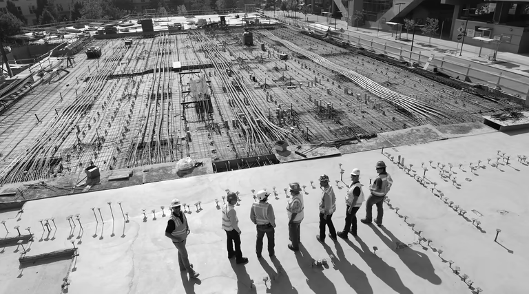
Field 3D laser scanning in the US is typically billed by the day or hour on site, not per square foot. A full scan day runs $3,200 to $5,000; hourly rates fall between $200 and $500. The day rate includes same-day registration and point-cloud delivery, while hourly covers field time only - which is why a day is not simply eight times the hourly floor. With a survey-grade terrestrial scanner capturing up to 500,000 points per second, a crew can cover roughly 15,000 square feet of interior space in a single day at standard station spacing. If your first question is “how much per square foot,” there is no clean formula: what matters is how many scanner setups the building requires, not just its area. Narrow corridors, stairwells, interstitial MEP spaces, and multi-story exteriors all add setups and time.
Why Scanning Is Priced by Day, Not Square Foot
The field crew pays for site mobilization, travel time, scanner operation, and breakdown regardless of how many rooms they reach. A 20,000 sq ft open warehouse might take a single day. A 20,000 sq ft hospital with hundreds of rooms, multiple floors, locked access doors, and exposed mechanical spaces could take two or three. Both are “20,000 sq ft” on paper.
Quoting per square foot without knowing the site is a guess. Most providers quote scanning by the day or half-day and adjust once they understand site complexity, access restrictions, and required output format. There is no USIBD LOA or GSA standard that sets a price per square foot; those frameworks define accuracy and deliverable detail, not field labor cost.
The Three Scopes: What You Are Actually Buying
Scope A - Scan only (field capture). This is WeAre Capture’s core billable service. The crew arrives with a survey-grade terrestrial scanner, places scanner stations, collects data, and delivers registered point cloud files in E57 and RCP/RCS format. Industry day rates for this scope typically run $3,200 to $5,000. If you already have an in-house BIM team or a registration workflow, scan-only is the scope you want. You get raw, high-accuracy field data and handle the rest.
Scope B - Modeling only (no field scan). If you already have a point cloud, the modeling work can be scoped separately. Modeling scope: shell and basic geometry runs $0.10 to $0.30 per square foot; dense MEP-inclusive Revit models run $1 to $10 or more per square foot. Hourly modeling rates typically fall between $50 and $150. The wide range reflects LOD: an LOD 200 massing shell is fast; an LOD 350 coordinated mechanical, electrical, and plumbing model is detail-intensive.
Scope C - Turnkey (scan plus model or drawings). A single project price covering field capture through final deliverable. Basic turnkey at LOD 200 to 300 runs roughly $0.50 to $3 per square foot on typical mid-size buildings, falling to $0.10 to $0.20 on very large open footprints where area dominates. High-MEP or LOD 350 turnkey runs $3 to $10 per square foot. The sections below break these ranges out by building type.
Turnkey Ranges by Building Type
These are vendor-derived US market ranges, not a neutral benchmark. Your project may fall outside them.
| Building type | Approximate range |
|---|---|
| Small commercial under 10,000 sq ft | $2,500 - $6,000 |
| Mid-size office, 10,000 - 50,000 sq ft | $6,000 - $25,000 |
| Large office or school, 50,000 - 100,000 sq ft | $15,000 - $35,000 |
| Warehouse, 100,000 - 500,000 sq ft | $18,000 - $90,000 |
| Hospital or healthcare facility | $25,000 - $120,000+ (often phased) |
| Industrial (varies widely) | $10,000 - $100,000+ |
Warehouses scan fast because they are open and repetitive. Hospitals cost more because of restricted access, dense MEP, and regulatory coordination requirements that drive up scan time and model depth.
What Drives Cost Up or Down
LOD and deliverable depth. Moving from LOD 300 to LOD 350 typically adds 30 to 40 percent to modeling cost. LOD 200 shell geometry is a different product from a coordinated RVT or IFC model your MEP engineers can use for clash detection.
Rush timeline. A compressed timeline typically adds 25 to 40 percent to the total. On the scanning side, rush can mean an after-hours mobilization, which runs roughly 1.5 times standard labor rates.
Licensed surveyor requirement. Some jurisdictions or project types require a licensed land surveyor to certify the field data. Expect $3,000 to $5,000 added to the project cost for certification.
Site access and complexity. Locked areas, confined spaces, roof access, live-facility restrictions, or multi-story atria all add scanner setups and time. A clean, accessible floor plan scans faster and costs less.
Location. Remote or rural sites add mobilization cost and travel time. On multi-day stays the per-day economics improve somewhat, but travel usually offsets the difference when the site is far from a major metro.
Output format. Delivering a registered E57 or RCP/RCS point cloud is simpler than delivering a fully coordinated Revit model (.RVT or .IFC). DWG drawing production is separate from scanning labor. The deliverable you need is a primary cost driver.
How the Scanning Process Works
Our primary instrument is a time-of-flight survey-grade terrestrial laser scanner. The crew places it on a tripod, triggers a 360-degree scan, moves to the next station, and repeats. Each station captures tens of millions of points in minutes; the scanner’s self-leveling and automatic target recognition speeds up station-to-station registration. At the end of the day, all stations are registered into a unified coordinate system in Trimble RealWorks or Autodesk ReCap, producing the point cloud the modeling or drafting team works from.
Industry-typical accuracy for this class of scanner runs 2 to 3 mm at the scanner, with accumulated registration error commonly held to 5 to 10 mm across a full building on a well-controlled project - actual results depend on site conditions and are not guaranteed. Deliverables include E57 for interoperable exchange and RCP/RCS for Revit workflows.
Scan-to-BIM: What It Adds to the Cost
Scan-to-BIM means converting a point cloud into a Revit model (.RVT) or similar BIM format. The model is built from the registered point cloud to the agreed LOD and category scope. Cost depends on LOD, categories in scope (architectural-only vs. structural vs. MEP), and the complexity of the existing conditions. See scan-to-BIM services for deliverable detail. If you need the full project priced including scanning, that falls under turnkey scope.
For as-built documentation - floor plans, elevations, sections, and reflected ceiling plans in DWG or PDF - see as-built documentation.
Get a Scope for Your Project
Project cost depends on too many variables to estimate usefully without knowing the building. If you can share the location, approximate square footage or object size, site access situation, and what you need to receive at the end, we can scope the work accurately.
Frequently Asked Questions
How much does 3D laser scanning cost?
Field scanning in the US is billed at $3,200 to $5,000 per day (including same-day registration and point-cloud delivery) or $200 to $500 per hour for field time alone. Turnkey projects (scan plus model or drawings) run from roughly $0.10-0.20 per square foot on very large open buildings to $10 on dense MEP - most mid-size projects land between $0.50 and $3. There is no single per-square-foot rate for scanning alone because cost depends on site complexity, not just area.
How does 3D laser scanning work?
A survey-grade terrestrial laser scanner fires a laser beam in a 360-degree pattern and records the return signal to calculate the distance to each surface point. A full scan day produces hundreds of millions of measurement points, registered into a unified coordinate system and delivered as an E57 or RCP/RCS point cloud. That file becomes the basis for Revit modeling, CAD drafting, as-built documentation, or other downstream work.
What is scan-to-BIM?
Scan-to-BIM is the process of using a point cloud from a laser scan to build a Revit model or other BIM deliverable. The point cloud captures the existing conditions of a building; the BIM model is built on top of it to an agreed level of detail (LOD 200, 300, or 350) and set of categories (architectural, structural, MEP). The result is a usable .RVT or .IFC file rather than a raw point cloud.
What are as-built drawings?
As-built drawings record the existing condition of a building as it was actually built, not as originally designed. They typically include floor plans, elevations, sections, and reflected ceiling plans at a documented accuracy level. When produced from a laser scan, they come from the registered point cloud rather than hand measurement. USIBD LOA standards define measurement accuracy for these deliverables; they do not set price.
Is there a standard price per square foot for 3D laser scanning?
No. USIBD LOA definitions and GSA BIM guidelines define deliverable accuracy and model content, not field pricing. Market rates vary by project complexity, LOD, building type, access, and turnaround. The ranges in this guide are vendor-derived US market estimates, not a neutral benchmark.